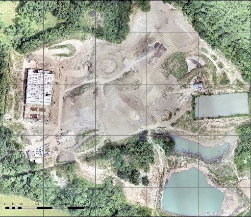
Topographical Surveying and Mapping
Client: Rural Arisings
- Aerial photography and orthmosaic
- Digital surface modelling
- Contours and spot heights derived from photogrammetry.
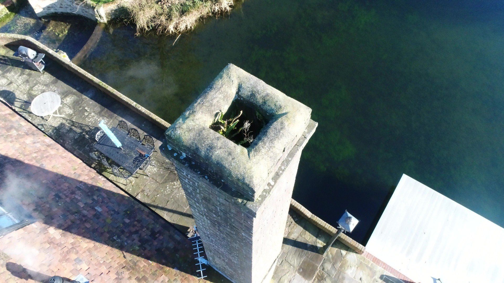
Aerial Inspections
Private Client Roof Inspection
- High quality imagery and video
- Access hard to reach areas
- Quick and easy to undertake
3d Mesh Modelling
- Volumetrics
- Inspections
- 3d modelling
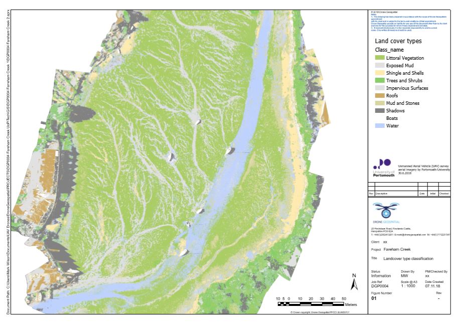
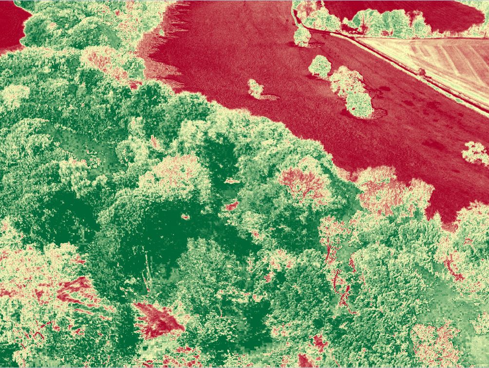
Raster Classification from Orthomosaics
Working with Portsmouth University
Raster analysis to produce land use classification maps for analysis:
- Area calculations
- Temporal changes and habitat monitoring
- Survey hard to access areas other than by UAV
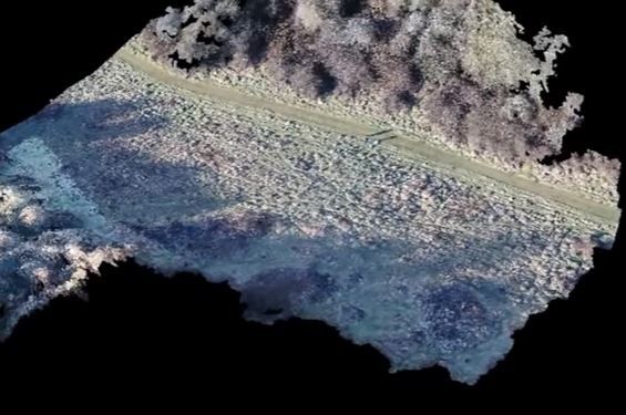
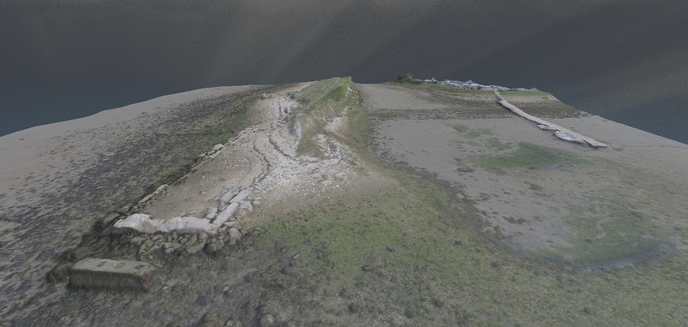
3D Point Cloud Model
- Aerial inspection and modelling
- 3D Point cloud derived model
- Fly through
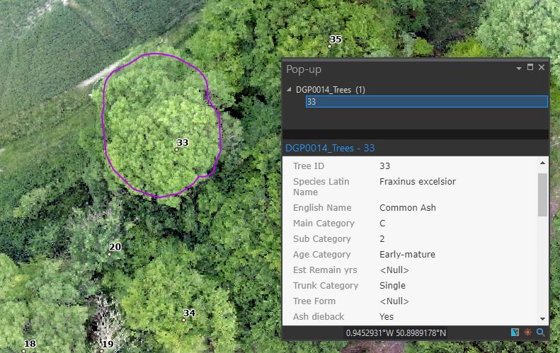
Aerial Tree Surveys
- Collect aerial imagery and produce georeferenced orthomosaic aerial
- Use Arc Collector to record tree information BS 5837
- Assess Ash tree health by visual inspection and using vegetation indeces
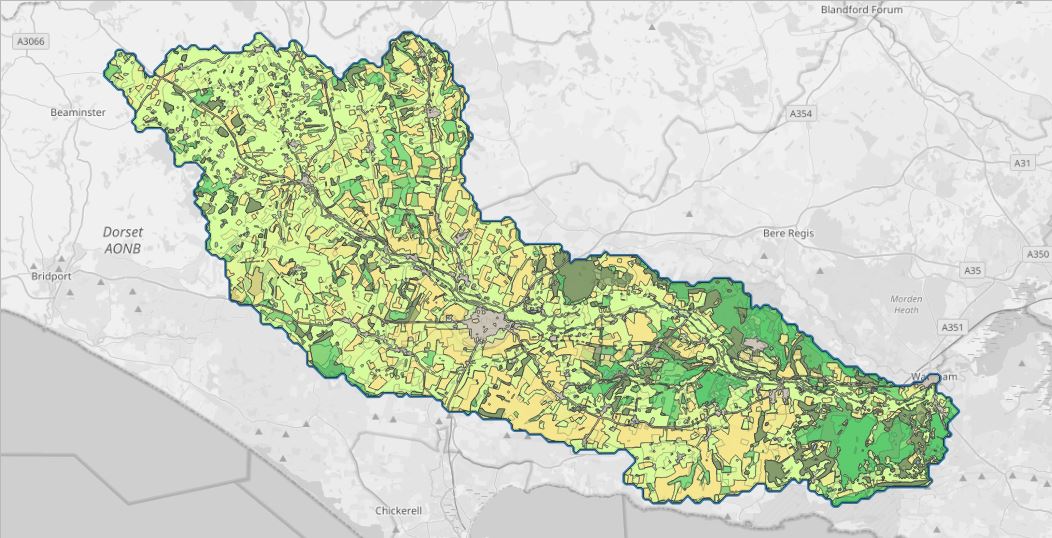
Land Use Change
Working with the Geodatda Institute at Southampton University
Comparison of 1940s and 2015 landuse patterns in the Frome Valley, Dorset
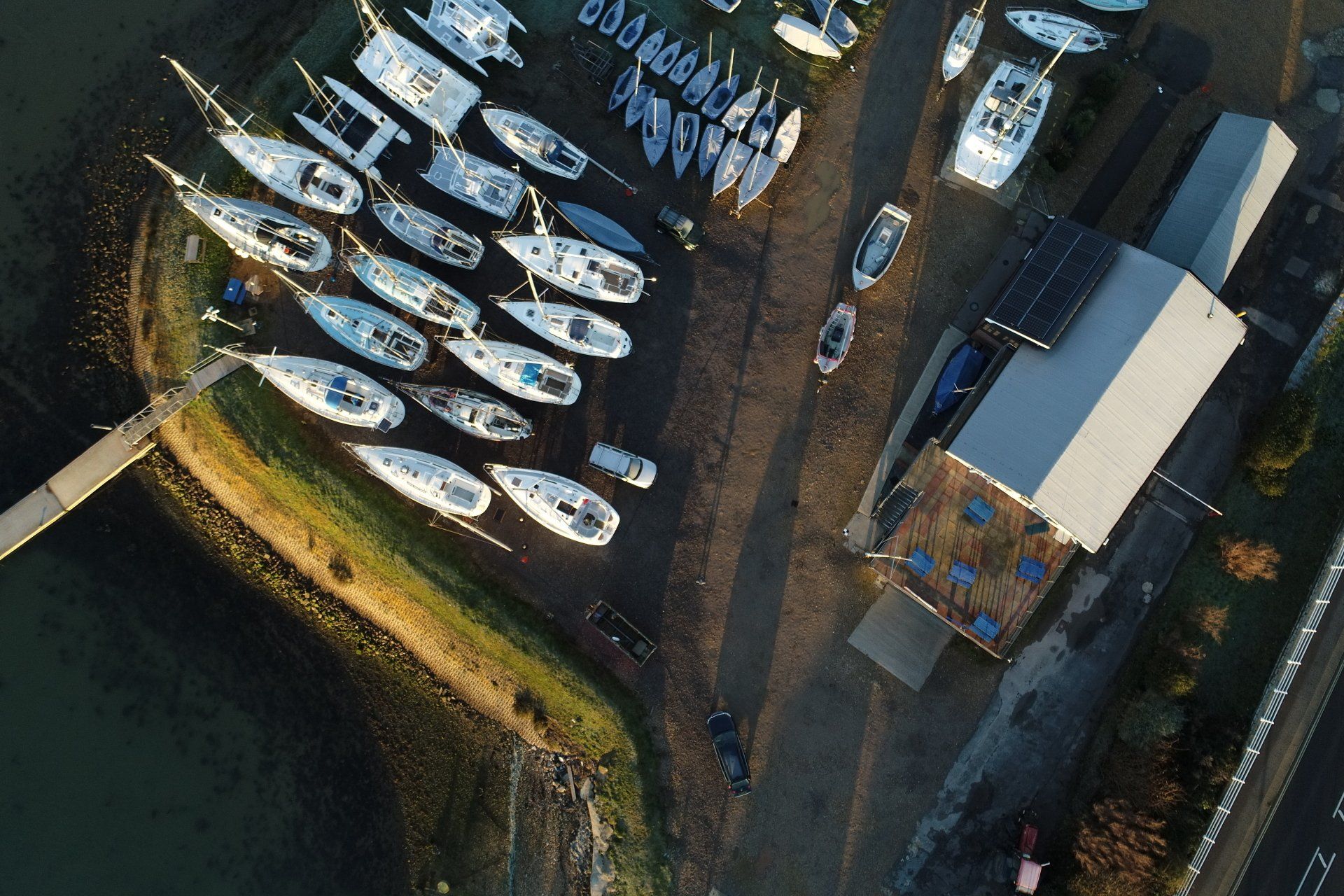
Langstone SC Boat Park
Aerial survey and record of boat berths
Woodland Restocking + Canopy Health
- Restocking awkward areas in woodland with standards
- Canopy health assessment using NDVI